| Version 20 (modified by olha, 17 years ago) (diff) |
|---|
Plone Google Maps
Plone Google Maps (qPloneGoogleMaps) is a Google Maps view product for the Plone content management system which enables integration of Google Maps into Plone sites.
Links
- Home Page - http://quintagroup.com/services/plone-development/products/google-maps
- Repository - http://projects.quintagroup.com/products/browser/qPloneGoogleMaps
- Releases - http://plone.org/products/plone-google-maps/releases
Plone Google Maps Features
- Due to qPloneGoogleMaps you can set up the latitude and longitude of your site objects and have their maps exhibited on your site.
- Any object with the latitude-longitude has an additional map portlet displaying this object. This portlet, in turn, has a template "Large screen". If you click on the large screen below the portlet, you will be able to see the full-size map of the page with its description.
- The folders containing objects with the latitude-longitude parameters have an additional display view - "maps view", which gives an opportunity to see the full-size map with all these objects.
- There is a new content type "Map" which can have other content types - "overlays". It enables the positioning of different objects on one map showing them with the markers of different colours.
Plone Google Maps Installation
- Install qPloneGoogleMaps and geolocation as Zope products
- Install these two products in your Plone instance with Quick Installer (Plone Control Panel ->Add/remove Products)
How To Use qPloneGoogleMaps
'
Use Case 1
Let's assume you need to show two objects (Plone pages) situated in one folder on one map.
- Suppose you have a folder "School"
- Create two pages for this folder ("School 1", "School 2")
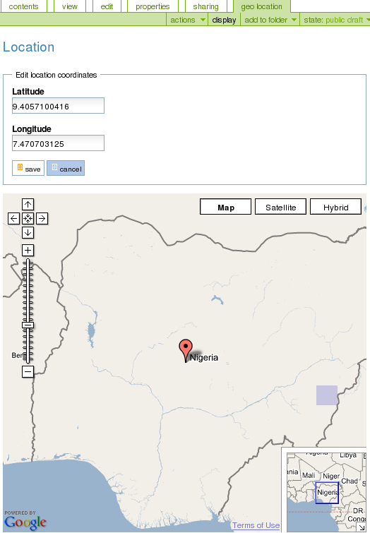
- Go to the page "School 1" and click on the tab "geolocation"
- You will see a page with the latitude and longitude fields and an empty Google map. Fill in the fields with the latitude and longitude values, click the "Save" button and you will see the changes on the map below:
http://quintagroup.com/services/plone-development/products/google-maps/geolocation.png
- Do the same steps for the page "School 2"
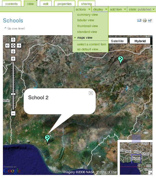
- Go to the folder "School"
- Choose "maps view" from the "display" drop-down menu. You will see the map with both of these objects ("School 1", "School 2") marked with the markers. If you click on one of these markers you will see its name appear beside it (after the click on this name you will be taken to the page the marker displays)
http://quintagroup.com/services/plone-development/products/google-maps/mapsview.png
Use Case 2
Let's assume, you need to show many objects situated in differnt folders on one map.
- Suppose, you have a folder "Nigeria".
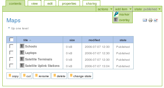
- Go to this folder and add "map" item from the "add item" drop-down menu.
- If you go to the "map" you've created, you will notice that it can have an additional content type "overlay":
http://quintagroup.com/services/plone-development/products/google-maps/overlay.png
- Choose "overlay" from "add item" drop-down menu
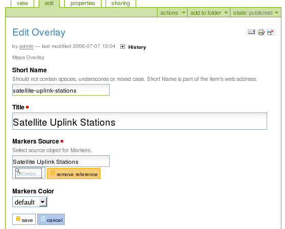
- Enter Short Name and title of a new overlay (f.eg. "Satellite Uplink Stations")
http://quintagroup.com/services/plone-development/products/google-maps/editoverlay.png
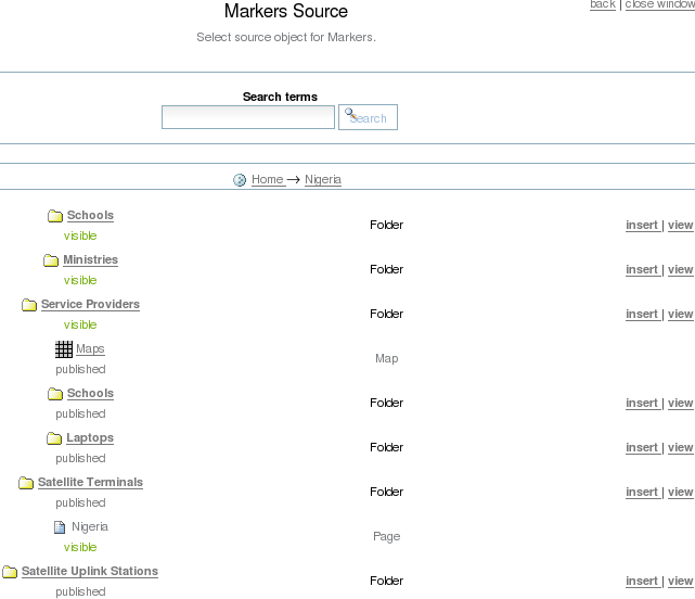
- Click "browse" button for the "Markers Source" pop-up window to appear
- now choose the folder containing the object with the latitude-longitude parameters you want your marker to be tied to ("Nigeria=>"Satellite Uplink Stations") and click "insert":
http://quintagroup.com/services/plone-development/products/google-maps/markers-source.png
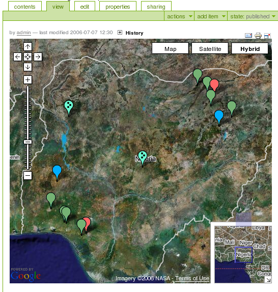
- Return to the "Edit Overlay" page to select the marker's color which will be shown on the map
- Click the "Save" button
- Complete the same steps for creating overlays for other objects of the folder "Nigeria"
- Go to this folder and choose the map. It will look like this:
http://quintagroup.com/services/plone-development/products/google-maps/wholemap.png
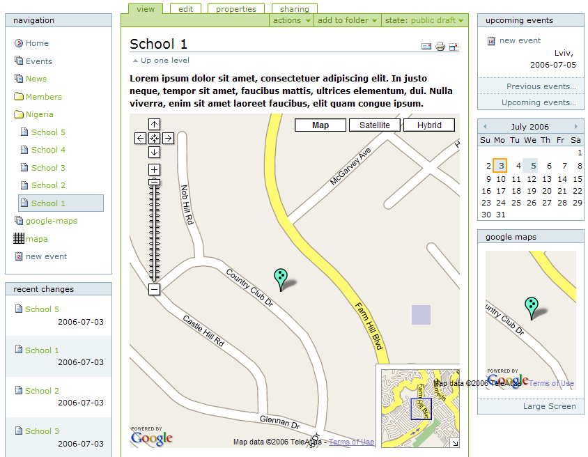
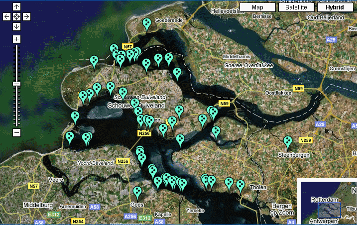
Here is one more example of how qPloneGoogleMaps product works:
http://quintagroup.com/services/plone-development/products/google-maps/google-maps.png